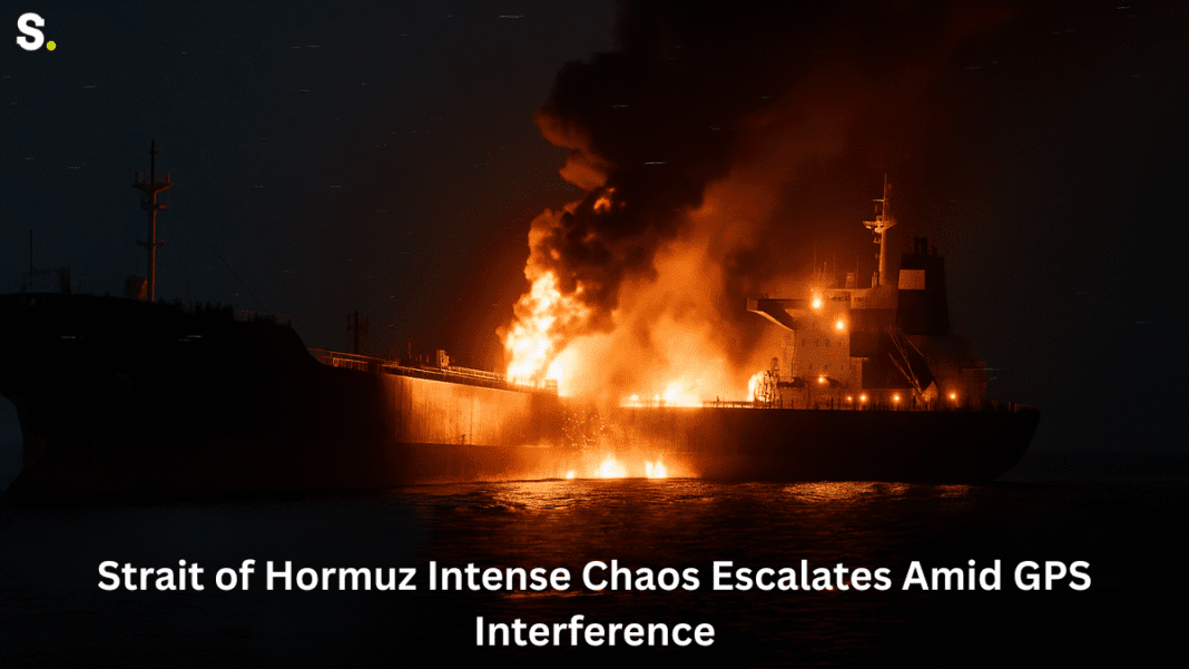
A strange event occurred near the Strait of Hormuz, one of the busiest and most important waterways in the world. An oil tanker named Front Eagle, sailing under the Liberian flag, began to behave unusually.
Unusual Ship Movements Spark Alarm
It sent out signals showing that it was jumping dozens of miles within seconds—an impossible movement. A massive fire was started shortly after the Front Eagle collided with another oil tanker.
This was not an easy error. Experts surmise that interference with the ship’s GPS system was the cause of this peculiar behavior. The Global Positioning System, or GPS, uses satellite signals to assist ships in locating themselves. Ships may become confused about their true location if these signals are interfered with. This can be harmful in addition to being perplexing.
In this case, the Front Eagle’s sudden and strange movements may have played a role in the collision. Many people think GPS interference along the strait is to blame for the tragedy, even though the exact cause is yet unknown. This area is close to Iran, which has been in a tense situation following a recent military conflict. After this conflict, many ships and aircraft in the region began showing weird patterns—sailing over land, spinning in circles, or even appearing stacked on top of each other. These signs all point to GPS disruption.
🚢 Strait of Hormuz on Edge: Mysterious Fires, Electronic War, and Iran-Israel Conflict Rock Oil Route
Impact Felt Across the Gulf
The Strait of Hormuz is a vital yet constrained path. Around one-third of the world’s oil that travels by sea passes through it every day. That’s why this region is so closely watched. Any disturbance here can have effects on global trade.
Several ships, not just the Front Eagle, reported GPS issues. During just two hours on a recent Tuesday morning, at least 170 ships showed signs of having GPS problems. These included incorrect positions, impossible routes, and mass confusion in navigation systems—all in or near the Strait of Hormuz, a critical waterway for global oil transport.
Some organizations that help ships stay safe in the region confirmed the interference. They said the problem was coming from around Bandar Abbas, a port area in Iran, which lies close to the Strait of Hormuz. Because of this, ships were advised to avoid using GPS and instead rely on radar and visual lookouts while navigating through the area.
Even the United Kingdom’s maritime safety group warned ships about this interference. They said it was having a serious impact and making it much harder for vessels to safely move through the Gulf, especially through the narrow and heavily used Strait of Hormuz.
Because of the increased risk, the company that owns the Front Eagle, one of the world’s biggest oil tanker companies, has now refused to take on new contracts to travel through the strait. They don’t want to risk more accidents caused by confusing signals.
A New Kind of Threat at Sea
GPS interference can happen in two main ways. One method is called “jamming,” where strong radio signals block the GPS signals from satellites. The other is called “spoofing,” where fake signals trick GPS devices into thinking they are somewhere else. In both cases, the result is that ships may believe they are in a different location than they actually are, which can be extremely dangerous—especially in narrow and busy waterways like the Strait of Hormuz.
Iran’s GPS-Free Missile Stuns the West! Qassem-Basir Bypasses Jamming, Signals New Era in Warfare
Experts say this kind of interference can throw off a ship’s autopilot system. If the GPS is showing a false location, a ship may steer in the wrong direction without anyone noticing—especially if the crew is relying too much on the technology. In the Strait of Hormuz, where navigation space is limited and ship traffic is heavy, even small errors in location data can lead to serious accidents.
This is likely what happened just before the Front Eagle hit another tanker, called the Adalynn. At the last moment, the Front Eagle suddenly turned and collided with the other ship. Even though radar and human lookouts are supposed to prevent this kind of crash, heavy GPS confusion in the Strait of Hormuz might have made things more difficult and reduced the crew’s ability to respond in time.
Navigation systems don’t always return to normal quickly after being affected. Sometimes, even after interference ends, the ship’s systems may still show the wrong location. That adds to the danger.
These GPS attacks are not new. They’ve been reported in other parts of the world too, such as in Ukraine, the Baltics, and near India and Pakistan. But it’s hard to find out exactly where these signals are coming from, which makes it difficult to stop them.
In the Strait of Hormuz, the interference is likely coming from strong signals sent out to protect important facilities from drone attacks or missile strikes. These powerful signals can affect not just ships, but also planes and even mobile phones. When GPS signals are jammed or spoofed, even the best technology can fail.
🚢 Red Sea Maritime Crisis Deepens as GPS Failures and Missile Threats Persist Despite Ceasefire
This makes it clear: relying only on GPS in a busy and narrow waterway like the Strait of Hormuz can be risky. With so many ships passing through every day, any confusion in their positions can quickly turn into a serious accident. The recent events show how dangerous this invisible threat has become in modern sea travel.


