South central Texas is facing a severe disaster after devastating floods swept through the region on July Fourth. The floods caused major destruction, killing 119 people and leaving nearly 200 missing. Whole neighborhoods, roads, and farmlands were underwater, especially near the Guadalupe, San Gabriel, and Colorado Rivers.
Deadly Floods Leave Texas in Crisis
The situation is urgent. Homes have been devastated, families have been uprooted, and many places are still inaccessible. Emergency teams are working hard to search for missing persons, rescue trapped residents, and assess the overall damage. But their job has become more difficult due to cloudy weather, which blocks satellite images.
In response to this major emergency, NASA activated its Disasters Response Coordination System. This system brings together NASA’s aircraft, technology, and experts to assist with natural disasters in the U.S. and worldwide. NASA is now working with the Texas Division of Emergency Management, FEMA, and several relief organizations to support flood response operations.
Stunning Mars Discovery: Ancient Floods Reshaped Red Planet
NASA Aircraft Help Map Damage from the Sky
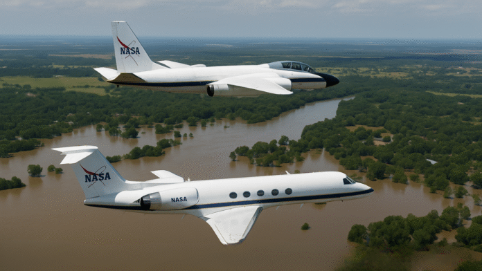
To help the rescue efforts on the ground, NASA has sent two aircraft with advanced technology. These planes are flying over the flooded areas, capturing images and radar data to help locate people and identify the most damaged places.
The first aircraft is the WB-57, a high-flying research plane. It took off from Ellington Field Joint Reserve Base in Houston and is equipped with a special camera system called DyNAMITE. This system is an acronym for Terrestrial Environments Day/Night Airborne Motion Imager. It captures high-resolution images from the sky — both during the day and night.
The WB-57 is focusing on the Guadalupe River and surrounding areas. It can cover large sections of land quickly and take very detailed pictures, even in cloudy or low-light conditions. These images are helping emergency teams spot washed-out roads, flooded homes, and isolated areas where people might be stranded.
UK Floods: Environment Agency Issues Urgent Warning
The second aircraft is a Gulfstream III jet, which flew in from NASA’s Armstrong Flight Research Center in California. This aircraft carries a radar system called UAVSAR, or Uninhabited Aerial Vehicle Synthetic Aperture Radar. Unlike cameras, this radar can “see” through trees and thick vegetation to detect floodwater hidden under forest cover or in rural areas.
UAVSAR is flying over multiple river basins, including the Guadalupe, San Gabriel, and Colorado rivers. Its radar scans help show just how wide the flooding is, especially in places not visible from the ground or blocked by trees and buildings. The aircraft will continue collecting data through the week.
Real-Time Data Supports Rescue Teams on the Ground
The data collected from these NASA flights is being immediately shared with emergency teams. Rescue crews, government agencies, and humanitarian groups are using this information to decide where to send boats, helicopters, and supplies.
Since satellites can’t provide clear images due to thick cloud cover, NASA’s aircraft are now offering the best available view of the disaster zone. With this data, officials can plan faster and more accurate search and rescue operations.
In addition to the raw images and radar data, NASA is also creating special flood maps. These maps will show:
- The size and depth of the flooding
- Damage to homes, buildings, and bridges
- Which communities are still under water
These maps are being published on the NASA Disasters Mapping Portal, where emergency teams can access and download them for use in their response planning.
The main goal of NASA’s mission is to help responders understand how widespread the flooding is and where the damage is most severe. This helps make sure that time, resources, and rescue efforts go to the right places.
NASA’s advanced technology and quick action are playing an important role in helping Texas during one of its most dangerous natural disasters in recent years.


